Ormiston Gorge

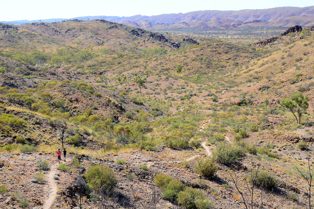
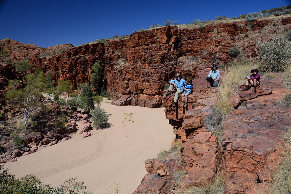
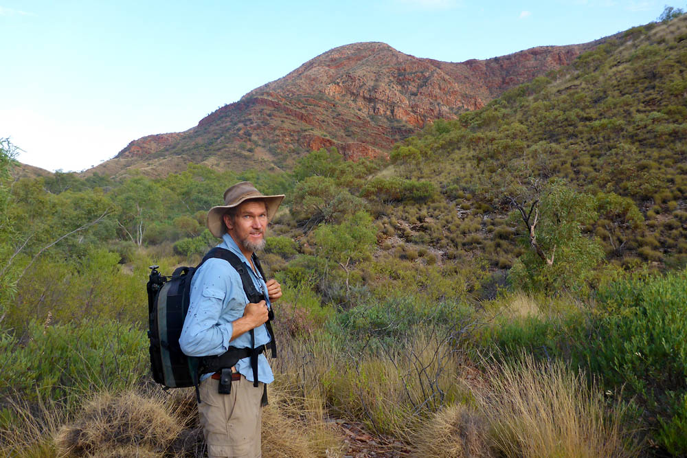
Pack up, hook up, drive out. Next stop, Ormiston Gorge, just 40 odd kilometres further west. Such a short hop meant our departure time wasn’t critical. Our first stop along the way was Serpentine Gorge, which some pundits claimed was ‘better than Standley Chasm’. Our response; ‘rubbish’, free does not necessarily mean better. Kris and the boys satisfied themselves with the short 2 km walk to the shady, but I must say slightly manky, waterhole. I thought I’d give Serpentine a chance and so climbed the short steep walk to the lookout. I was rewarded by a fabulous view up and along the gorge, with a narrow fissure or chasm visible in the far distance. Sadly this is not accessible with the waterhole full. The days have slowly been getting hotter, with most days now around 35 to 38 degrees. Not so bad as the humidity is still extremely low, but this combination turns you quite deliquescent, and really sucks the moisture from every pore.

DSC_1866The view from Serpentine Gorge lookout – worth the climb.

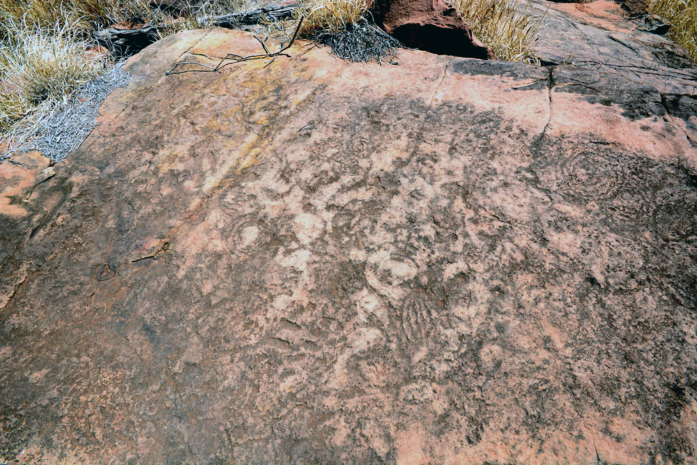
A few kilometres down the road were the Ochre Pits. I had always wondered where the aborigines obtained their ochre. The answer is from quarries just like this. Thin layers in the MacDonnell ranges that contain every hue from deep ruddy red, to orange, yellow and brilliant kaolin white. Signs warn of significant fines for removal of ochre, as it is still used in traditional aboriginal ceremonies. So it is disappointing that so many clumsy hand scrapes to remove a ‘souvenir sized’ sample are so obvious.

DSC_1871

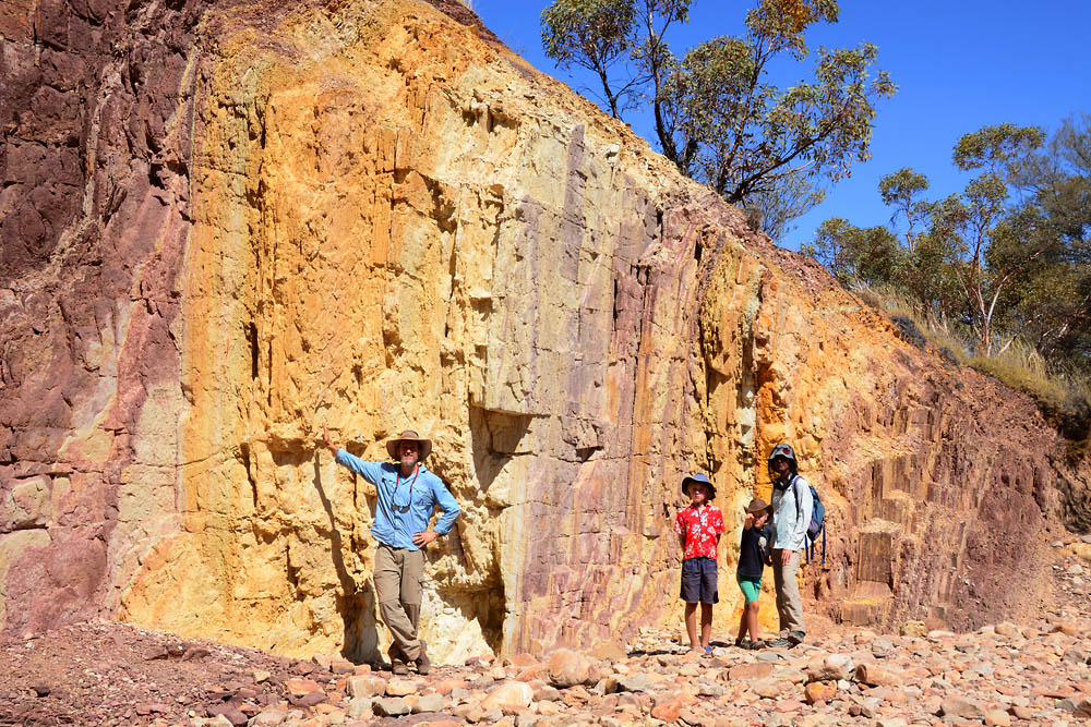
The ochre pits (notice I’m not touching the wall…).

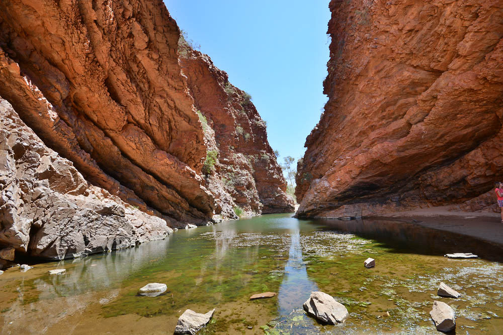
Just a few minutes later, we arrived at Ormiston Gorge. This sits in a national park, but has a privately run kiosk on site as well as hot showers. This is reflected in the tiered pricing. The fees here were more than three times those from Trephina Gorge in the East MacDonnell Ranges. After we all had a quick swim, Kris and the boys settled into the water hole (Kris to read, the boys to play on boogie boards), whilst I walked the Ghost Gum walk. This short climb offers a magnificent view straight down to the water hole, and then takes you a few more kilometres along the gorge.

DSC02656

P1070910

Views around Ormiston Gorge.

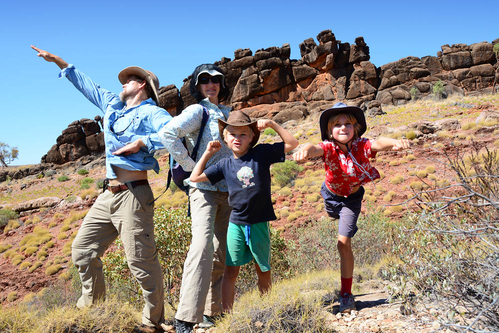
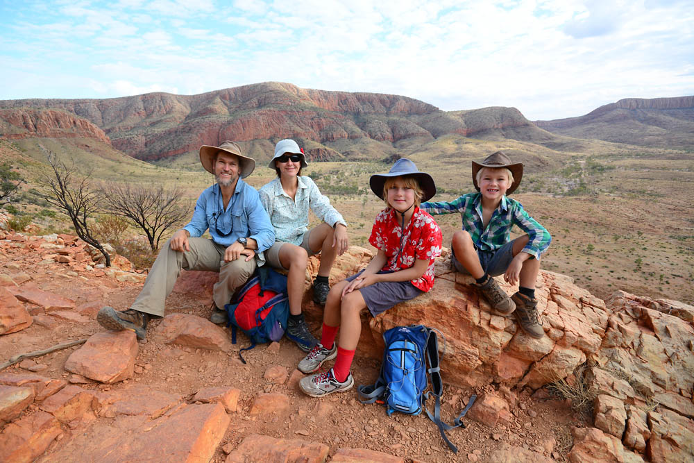
The big walk, Ormiston Pound (voted the number 1 walk in Australia according to the kiosk operator), was scheduled for early next morning to beat the heat. So we were up at 6:30 and out the door soon after. The first few kilometers were unrewarding, but this all changed when we walked up to the lookout, where the entire Pound was revealed. The view was absolutely magnificent. After obligatory photos and video were taken, we finished the rest of the walk, which takes you across the floor of the Pound, back along the gorge where massive chunks of pink and purple quartz litter the dry river bed. Sam was impressed with the gorge walls, which are very ‘blocky’ and look like they could have been constructed in Minecraft!

P1070914DSC_1876

Walking Ormiston Pound – quite spectacular!

IMG_3360DSC_1879DSC_1908

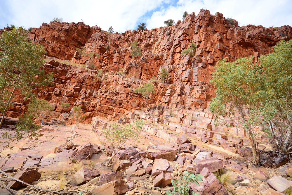
Blocky ‘Minecraft-esque’ walls.

DSC_1903DSC_1905

A magnificent example of 120 million year old seafloor.

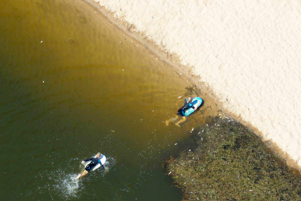
The boys final treat was an inflatable raft, kindly lent to them by Nick the friendly kiosk operator. Their excellent paddling skills meant they mostly went around in circles but they eventually managed to explore all corners of the water hole after working out the benefits of cooperative paddling.

DSC_1912

And around we go…

Elery Creek Big Hole

Under blue skies and a typical warm red centre morning, we headed in the opposite direction to visit the West Macs. Apparently this is the lingo for those in the know for the West MacDonnell Ranges. It is convenient that when you drive into Alice, you pass through a natural gap that divides the range neatly in half. First stop just out of town was Simpson’s Gap, a split in the range and an almost permanent water hole. No doubt a nice surprise for John McDouall Stuart when he passed by here in 1860.

DSC_1196

Simpsons Gap. Apparently it dries out only very rarely.

Next on the ‘West Macs’ list was Standley Chasm, a place many avoid because the T/O’s (Traditional Owners) slug you $10 per person to enter. The reality is that this is a fabulous place, quiet and tranquil, with sheer walls rising at least 30 m above you, a perfect refuge from the heat, even better if you’re there alone. If a small entry fee dictates whether people should visit a place of natural wonder, perhaps they should reconsider their entire trip.

DSC_1218

Kris contemplating the serenity of Standley Chasm.

DSC_1219

DSC_1221
After a rocky 2 km drive off the bitumen to Elery Creek Big Hole, we found a campsite on a not quite level block. A mix of our leveling ramp and some shovel work on the opposite wheel sorted that out. Clearly the money spent by National Parks runs out by the time they decide to level their sites.

DSC_1239

Elery Creek Big Hole.

We visited the swimming hole after setting up, one toe dab confirmed the water was COLD. A quick check with my watch confirmed it was indeed cold at 17.7 C. We thought we’d wait until the heat of the next day to brave any further submersion. Next morning, after a lovely 3 km walk around the dolomite rocks, we all went in. It didn’t get any warmer. The boys loved it though, and got the boogey boards out to paddle around the water hole. It probably helped that they were clad in their wet suits. We discovered later that Big Hole has been measured at 40 m deep!

DSC_1225

Sam and James enjoying the dolomite rocks on a section of the Larapinta Trail.

DSC_1234

Sam suggested we pose as superheros, could you guess?

Alice Springs

After a few gratuitous photos of our M*A*S*H (Moving Always Stuffy Home) in a dry-as-dry creek bed, we headed into Alice for the night. Another refuel, another restock. This time we stayed at the ‘G’Day Mate’ caravan park. The friendly operator Alan made up for the chintzy name. He was incredibly helpful, and lived up to the numerous positive comments on WikiCamps (courtesy of nomads with time to kill perhaps). Once set up, we headed straight for the pool – too cool for the locals at 22 degrees, but perfect for us. And by design or by luck, it was next to the laundry, so we could get washing done and check on the boys. One thing we noticed after the bush was the noise. All through the night we could hear constant traffic, occasional trains and even a few planes. Neither of us slept well.

DSC_1179

Kris posing at the creek crossing leaving Trephina Gorge.

Trephina Gorge

After a quick tyre rotation at Gemtree, and with 27,400 km on the Big Lap odometer, we hit the blessed bitumen and headed towards Alice Springs. En route we spotted a magnificent pair of Wedge Tailed Eagles feasting on carrion just before crossing the Tropic of Capricorn. These huge birds are easy to spot, but hard to photograph. They always seem to fly away from you once spooked. Most inconvenient.

P1070861

DSC_0619

Our fourth crossing of 23° 26′ 22″ South. The tropic of Capricorn is the southernmost latitude where the Sun can still be directly overhead.

DSC_0625

DSC_0629

Driving into Alice I spotted a public weighbridge and decided to check our bloat. With near empty fuel tanks, van and truck tipped the scales at 5.40 t!  Then, after a quick flyby into Alice Springs to refuel and restock at Coles, we headed back out (roughly) into the East MacDonnell Ranges. This 250 km long mountain range, which formed a billion years ago, and once dwarfed the Himalayas 400 million years ago, is said to be the forgotten treasure of the Red centre.  The drive in was certainly spectacular as we made our way to a NP camp ground at Trephina Gorge.  Unfortunately all the water holes here are currently dry.  The downsides were no swimming holes to cool off in and no large bodies of water for the feral European bees to be distracted by.

DSC_0637

We discovered this about half an hour after setting up camp when we noticed lots of bees crowding around a nearby dripping tap, then later, buzzing around moist socks, boots, us, or anything with even a skerrick of moisture. Their thirst is not surprising considering the humidity is well under 20%, read super brut-de-brut. An unpleasant by-product of this is static electricity build-up and the inevitable electrocution that follows. I tricked the little blighters later by turning the tap off tight and putting a sacrificial container of water well away from the van. This worked a treat and also became a bit of a gathering place for local birds.

DSC_0688DSC_1170

Some photographic fun at night, courtesy of steel wool lit in the fire.

We spent our days here walking around Trephina Gorge, including several trips up to the panoramic lookout to watch the sunset and stars pop out one by one, just magnificent. We also checked out some indigenous petroglyphs at N’Dhala Gorge, apparently some are of caterpillars.

DSC_0646IMG_3346 - Copy

The mesmerizing view from the Panorama Lookout, Trephina Gorge.

DSC_1131

Petroglyphs at N’Dhala Gorge. Hard to see, even with some Photoshop help!

Next visit was out to Arltunga, the site of a gold rush in the 1880’s and actually the largest European settlement in the NT at the time. It boasted 100 people in its heyday. Sam was very disappointed by the false advertising in the visitor information centre, which said you could try panning for gold. The creeks were dry, and the visitor information centre was open but had only rusted out pans and no wash in site. We called in to one of the underground gold mine entrances, wisely backfilled to prevent FARTS (Fatal Acts of Regular Tourism Stupidity). At least it was cool in the mine entrance.

DSC_1137DSC_1152

The dire circumstances that motivated people to hand push a wheel barrow 800 km from the last railhead at Marree through the most inhospitable country imaginable are simply unfathomable today. Most made only meagre livings and very few ‘struck it rich’. The last old-timer gold prospector, Jack Shaw died here in the 1980’s.

K – As a treat James and I walked up to the top of Panorama lookout on the last evening and watched all the stars come out.  It was truly a beautiful thing to share even though we were both a bit spooked after being kept awake the night before by several dingoes howling as they passed through the area.  Given the daily temps were now sitting around 34 degrees and the general lack of water we felt four nights out here was more than enough and were glad to be heading back into to Alice Springs where such things as air conditioning and pools would surely cool us down.  

Gemtree

After an efficient departure from our burr-ridden free camp, we continued west towards Alice Springs. The road quality had changed immediately after the NT border, with mild corrugations, very occasional bull dust and sharp stones covering the surface. We hit one of these with the front left tyre, so I wisely stopped to jack the wheel up, rotate and check for leaks – luckily there was no damage. Whilst I was under the car with the bonnet up – the unofficial bush sign of distress – two farmers utes passed going east, neither stopped. Along the Gibb River Road, so many people stop to help they almost get in the way! Better that way than to be ignored.

DSC_0268We never miss a cairn building opportunity!  This funny little line of 15 hills just popped up out of an otherwise flat landscape – all in a row, looking like the spine of an ancient dinosaur.

DSC_0269

After a lazy 302 km, we pulled into Gem Tree. This is a well known fossicking area and even more importantly, where the bitumen starts again! After shelling out for two nights at the rather barren caravan park as well as $85 to go garnet fossicking the next day, we all had well deserved showers (despite the boys’ unsuccessful arguments to convince us they did not need showers – De rigour I’m afraid).

At 8 am next morning, we met to collect our sieves, shovel, pick and 20 l water drum, and followed our resident fossicking expert (read Grey Nomad here for his first season) to the site. The boys had fun, at least for the first half hour, when they realised that fossicking is hot dusty hard work, and that the gems are small and hard to spot.

P1070855

P1070852

After 3 hours we packed up our gear – I had the sense to dry sieve enough to allow a few more turns wet washing back at the van. Our efforts were not in vain. We collected probably 50 stones, several of which were later assessed to be of cuttable gem quality. The decision now, as with our tiny sapphires from Rubyvale, is what to do with these pretty coloured stones?

DSC_0277Gemtree campsite.